Within Marshall Weird
How Could Navigators Read Invisible Islands?
Traditional Marshallese navigation can seem uncanny because navigators read island effects in waves that outsiders rarely notice.
On this page
- Stick charts as teaching tools
- Dilep and island wave shadows
- Indigenous skill versus paranormal mystery
Page outline Jump by section
Introduction
To outsiders, traditional Marshallese navigation can sound almost supernatural. Stories tell of expert canoe navigators steering towards islands long before any land appeared above the horizon, as though they could detect places that were literally invisible. The reality is no less remarkable. Rather than relying on mysterious powers, Marshallese navigators developed an exceptionally refined way of reading the sea itself. By feeling how long ocean swells changed as they encountered distant atolls, they could infer the presence and direction of land hidden beyond the curve of the Earth. Even today, some aspects of this knowledge remain only partly understood by modern science, giving rise to one of the Marshall Islands’ most enduring “mysteries”: not whether invisible islands exist, but how human beings learned to sense them through waves.[The Oceanography Society]tos.orgwave navigation in the marshall islands comparing indigenous and western scThe Oceanography SocietyWave Navigation in The Marshall Islands2 Oct 2015 — In the Marshall Islands, navigators remotely sense land by de…
How could navigators read invisible islands?
A low coral atoll may rise only a few metres above sea level. In clear weather it disappears below the horizon when a canoe is still tens of kilometres away. Yet experienced Marshallese navigators did not depend solely on eyesight. They combined observations of stars, birds, winds, clouds and currents with an extraordinary awareness of the movement of ocean swells beneath their canoe.[The Oceanography Society]tos.orgwave navigation in the marshall islands comparing indigenous and western scThe Oceanography SocietyWave Navigation in The Marshall Islands2 Oct 2015 — In the Marshall Islands, navigators remotely sense land by de…
Ocean swells differ from the short, wind-driven waves that most people notice. Generated by distant weather systems and persistent trade winds, swells can travel across enormous distances while keeping a consistent rhythm. When these swells encounter an atoll, they bend around reefs, reflect from shorelines and interact with one another. These subtle distortions create patterns that extend far beyond the visible island itself.
Marshallese navigators learned to recognise these patterns by the motion of the canoe. Rather than watching the sea, they often concentrated on how the vessel pitched, rolled and vibrated beneath them. According to ethnographic accounts, some even lay down in the canoe to feel the changing movements more precisely.[The Oceanography Society]tos.orgwave navigation in the marshall islands comparing indigenous and western scThe Oceanography SocietyWave Navigation in The Marshall Islands2 Oct 2015 — In the Marshall Islands, navigators remotely sense land by de…
For someone unfamiliar with the system, this ability can seem paranormal. In practice it reflects generations of accumulated experience, memorisation and training.
Stick charts as teaching tools
Perhaps the most famous symbols of Marshallese navigation are the delicate stick charts made from coconut midribs tied together with fibre and marked with shells.
These objects are often misunderstood as nautical maps carried aboard canoes. They were not. Instead, they functioned primarily as teaching devices, helping apprentices visualise how swells behaved around particular atolls before setting out to sea. Once the principles had been learned, the charts stayed ashore while the navigator relied on memory and observation.[The Oceanography Society]tos.orgwave navigation in the marshall islands comparing indigenous and western scThe Oceanography SocietyWave Navigation in The Marshall Islands2 Oct 2015 — In the Marshall Islands, navigators remotely sense land by de…
Three broad forms are commonly recognised:
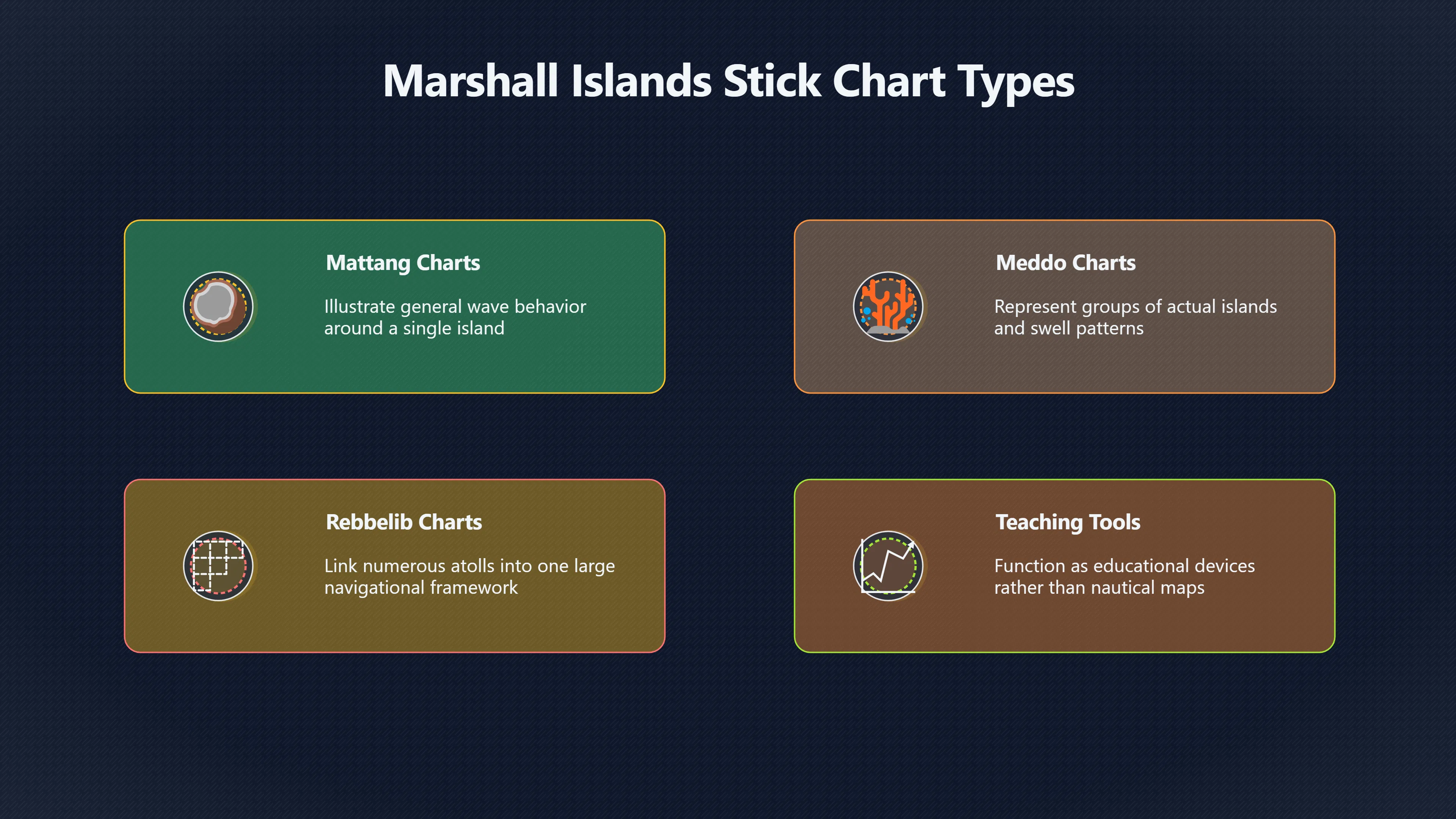
- Mattang charts illustrated general wave behaviour around a single island and were mainly educational.
- Meddo charts represented groups of actual islands and their associated swell patterns.
- Rebbelib charts covered much larger parts of the Marshall Islands, linking numerous atolls into one navigational framework.[Wikipedia]WikipediaMarshall Islands stick chartMarshall Islands stick chart
The apparent simplicity of these charts hides considerable complexity. The curved sticks do not represent coastlines but relationships between swells, while shells indicate islands whose influence on the sea extends well beyond their visible landmass.

Dilep and the idea of island wave shadows
Among the most discussed Marshallese concepts is the dilep, often described as a wave pathway connecting two islands.
Traditional navigators describe the dilep as a navigable line that can guide a canoe between distant atolls. Exactly what physical process creates this feature remains debated. Some researchers argue that it reflects interference between multiple swell systems. Others suggest it may arise from reflections and refractions around islands under particular sea conditions. Despite decades of study, no single oceanographic explanation has gained universal acceptance.[tos.org]tos.orgwave navigation in the marshall islands comparing indigenous and western scThe Oceanography SocietyWave Navigation in The Marshall Islands2 Oct 2015 — In the Marshall Islands, navigators remotely sense land by de…
Modern fieldwork has shown that at least some traditional wave signs correspond closely with measurable physical effects. Satellite imagery, wave buoys and numerical wave models demonstrate that islands generate crossing swell patterns in their lee and alter incoming trade-wind swells over distances of many kilometres. These findings support part of the navigators’ knowledge while leaving other reported patterns, including some descriptions of the dilep, only partly explained.[The Oceanography Society]tos.orgwave navigation in the marshall islands comparing indigenous and western scThe Oceanography SocietyWave Navigation in The Marshall Islands2 Oct 2015 — In the Marshall Islands, navigators remotely sense land by de…
This uncertainty has fuelled the reputation of the dilep as one of the Pacific’s great navigational mysteries. The mystery, however, lies less in whether navigators possessed hidden powers than in whether modern oceanography has yet identified every subtle interaction occurring on the open sea.
Why it acquired a mystical reputation
European visitors often struggled to understand how navigators repeatedly reached tiny coral islands with no obvious landmarks. Before systematic anthropological research, some accounts treated the skill almost as magic or instinct.
Several factors encouraged this impression:
- The techniques depended on bodily perception that is difficult to demonstrate verbally.
- The knowledge was traditionally restricted to trained navigators rather than shared publicly.
- Successful navigation often involved combining many environmental clues simultaneously rather than following a single rule.
- Some concepts have no direct equivalent in Western nautical terminology, making translation difficult.[eScholarship]escholarship.orgAbstract: Marshallese wave navigation remains one of the least understood systems of traditional spatial orientation in Oceania…
Because the expertise was transmitted orally and through apprenticeship, outsiders sometimes interpreted the knowledge as mystical simply because they lacked access to the training behind it.
Indigenous expertise versus paranormal mystery
From a Fortean perspective, wave navigation occupies an unusual position. It genuinely produces experiences that appear uncanny. A navigator who confidently turns towards land that nobody else can see naturally inspires stories of hidden perception and invisible islands.
Yet the strongest evidence points towards extraordinary human skill rather than supernatural ability.
Research combining anthropology with physical oceanography has confirmed that islands leave detectable signatures in surrounding swell fields. Scientists have successfully modelled several of these effects, including crossing wave patterns behind islands and interactions between incoming and reflected swells. At the same time, researchers acknowledge that not every traditional concept has been fully explained using present-day models.[The Oceanography Society]tos.orgwave navigation in the marshall islands comparing indigenous and western scThe Oceanography SocietyWave Navigation in The Marshall Islands2 Oct 2015 — In the Marshall Islands, navigators remotely sense land by de…
This balance makes Marshallese wave navigation especially significant within the country’s strange-history record. Unlike many Fortean subjects, it is neither straightforward folklore nor a solved scientific puzzle. It sits at the boundary between indigenous environmental knowledge and modern investigation, reminding us that what first appears mysterious may represent expertise developed through centuries of careful observation.
Why the story still matters
Interest in Marshallese wave navigation has grown alongside efforts to revive traditional canoe voyaging and preserve cultural knowledge. Scholars, navigators and Marshallese organisations have worked together to document techniques before they disappear, while recognising that not every aspect can be fully captured in written descriptions or mathematical models.[The Oceanography Society]tos.orgwave navigation in the marshall islands comparing indigenous and western scThe Oceanography SocietyWave Navigation in The Marshall Islands2 Oct 2015 — In the Marshall Islands, navigators remotely sense land by de…
For readers interested in the stranger side of the Marshall Islands, the enduring fascination is not that navigators found mythical islands. It is that they learned to detect real ones long before they became visible, using patterns in the sea that most people never notice. That combination of practical success, cultural tradition and remaining scientific uncertainty continues to make wave navigation one of the most compelling and intellectually honest mysteries associated with the islands.
Amazon book picks
Further Reading
Books and field guides related to How Could Navigators Read Invisible Islands?. Use these as the next step if you want deeper reading beyond the article.
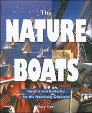
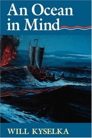
We, the navigators
Directly explains traditional navigation methods including wave reading.

eBay marketplace picks
Marketplace Samples
Live-tested eBay searches with available results related to this page.

Endnotes
1.
Source: Wikipedia
Title: Marshall Islands stick chart
Link:https://en.wikipedia.org/wiki/Marshall_Islands_stick_chart
2.
Source: escholarship.org
Link:https://escholarship.org/uc/item/43h1d0d7
Source snippet
Abstract: Marshallese wave navigation remains one of the least understood systems of traditional spatial orientation in Oceania...
3.
Source: tos.org
Title: wave navigation in the marshall islands comparing indigenous and western sc
Link:https://tos.org/oceanography/article/wave-navigation-in-the-marshall-islands-comparing-indigenous-and-western-sc
Source snippet
The Oceanography SocietyWave Navigation in The Marshall Islands2 Oct 2015 — In the Marshall Islands, navigators remotely sense land by de...
Additional References
4.
Source: indico.cern.ch
Link:https://indico.cern.ch/event/436444/attachments/1201912/1749612/Art_of_Wayfinding_2-1.pdf
Source snippet
Piloting and Stick Charts of the Marshall IslandsWave Piloting and Stick Charts of the Marshall Islands. Marshall Island wave piloting by...
5.
Source: scispace.com
Link:https://scispace.com/pdf/resolving-ambivalence-in-marshallese-navigation-relearning-2j3ve9fk8c.pdf
Source snippet
om different navigation schools in the Marshall Islands who modeled their...Read more...
6.
Source: researchgate.net
Title: ‘stick charts’ used by the naval navigators …
Link:https://www.researchgate.net/publication/273650685_Wave_Navigation_in_the_Marshall_Islands_Comparing_Indigenous_and_Western_Scientific_Knowledge_of_the_Ocean
Source snippet
(PDF) Wave Navigation in the Marshall Islands13 Mar 2026 — In the Marshall Islands, navigators remotely sense land by detecting how islan...
7.
Source: youtube.com
Title: Our Watery World: The Stick Charts of Micronesia | Great Maps Explained
Link:https://www.youtube.com/watch?v=moJ1cNEpvSo
Source snippet
Spatial orientation, navigation, & wave piloting in the Marshall Islands with Hugo Spiers & Joe Genz...
8.
Source: youtube.com
Title: The Story of Navigation in the Marshall Islands: Ancient Skills, Timeless Wisdom
Link:https://www.youtube.com/watch?v=FhYCr_Fx7CU
Source snippet
Wave Piloting in the Marshall Islands || Radcliffe Institute...
9.
Source: arxiv.org
Link:https://arxiv.org/abs/1802.09151
10.
Source: henry.baw.de
Link:https://henry.baw.de/bitstreams/0ded729c-5dc9-4b1b-8e6d-2a32de362c2c/download
Source snippet
Stick charts...Read more...
11.
Source: jstor.org
Link:https://www.jstor.org/stable/24029890
Source snippet
Marshallese Navigationby J Genz · 2014 · Cited by 49 — Marshallese took the common Oceanic land-finding technique of detecting how island...
12.
Source: youtube.com
Link:https://www.youtube.com/watch?v=p0IoNXyhZJc
Source snippet
The Ocean Shows Us the Way...
13.
Source: youtube.com
Title: The Ocean Shows Us the Way
Link:https://www.youtube.com/watch?v=q_X6s5MZnIQ
Source snippet
The Story of Navigation in the Marshall Islands: Ancient Skills, Timeless Wisdom...
Topic Tree